
🔎 Reverse Image Search
Image search techniques made simple: upload a photo or paste a URL and search 6 engines at once. 100% free, nothing stored.
🔒 Your image is never stored on our servers longer than 24 hours and is never shared.
You run a website, you want to show visitors where something is, and you are wondering: can I use Google Maps photos on my website? Google Maps has the perfect photo of the place, and it feels like the photo is just sitting there, free to take. It is not quite that simple.
Google Maps photos come under three different sets of rules, and the route you choose decides whether you are fine or in breach. This guide works through all three routes against Google’s own rules, the Geo Guidelines, with a real pub in London as the test case.
Short answer: you can show Google Maps and Street View on your website by embedding the map or linking to it with Google’s own tools. You cannot download, screenshot or copy the imagery and host it on your own site, and you cannot use it in print. Photos other people uploaded to Maps belong to them, so you need their permission.
What Counts as a Google Maps Photo?
Before the rules make sense, it helps to split one vague phrase into three different things. “Google Maps photos” usually means one of these, and each one has its own rule.
| Kind of photo | What it is | Who owns it |
|---|---|---|
| Map imagery | The map tiles, roads and labels Google draws | Google and its data providers |
| Street View imagery | The 360 degree photos Google’s cars and cameras capture | |
| User uploaded photos | Photos added to a listing by a business or a visitor | The person who took them |
Mixing these up is how most people get into trouble. An embed shows Google’s own imagery inside Google’s own frame, which Google allows. A screenshot takes that imagery out of the frame and puts it on your server, which Google does not allow. And a photo uploaded by a visitor is not Google’s to give away at all.
Three kinds of photo, three sets of rules, and the first question to ask is always which kind you are looking at.
Can I Use Google Maps Photos on My Website? The Three Routes Compared
Here is the whole answer in one table. The rest of this guide proves each row with the real test.
| Route | What you do | Google’s rule | Verdict |
|---|---|---|---|
| Embed the map | Paste Google’s iframe code on your page | Allowed, no permission needed, attribution built in | Safe |
| Screenshot Street View, upload it | Save a Street View image and host it yourself | You may not screenshot Street View imagery or remove it from embedded sources for any purpose | Not allowed |
| Screenshot for a printed guide | Print a Maps or Street View image in a leaflet or book | Do not use Google Maps imagery in print | Not allowed |
Two of the three routes fail. That is the honest result, and it matches what Google’s own AI Overview says for this exact question: embed or link with Google’s official tools, and do not download, screenshot or copy images to host on your own site.
Can I Embed a Google Map on My Website?
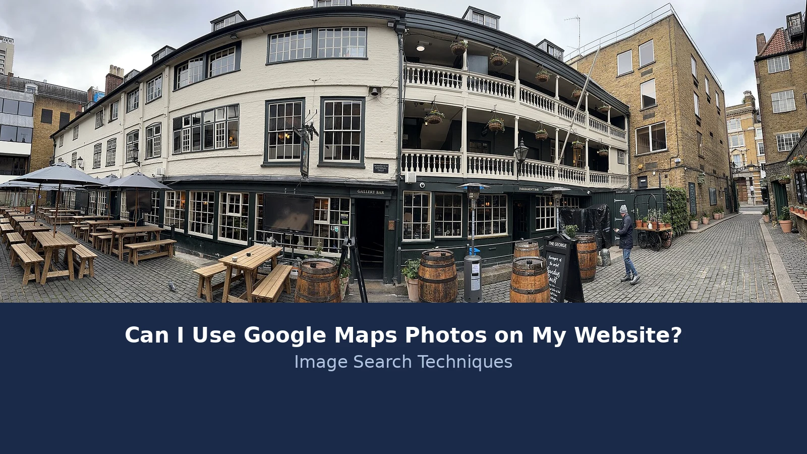
Yes, and this is the route I tested live. The scenario is a London travel blogger writing a guide to historic pubs, who wants a map showing where The George Inn is.
I tested this on 20 November 2026 with a real place: the pub listed on Google Maps as “George”, at 75 Borough High Street, London SE1 1NH. It is the historic coaching inn most people know as The George Inn, rated 4.3 stars from 7,612 reviews, and described on its listing as an authentic 17th century coaching inn and pub with oak beams and large courtyard seating.
Here are the steps, exactly as they worked on the day:
- Open Google Maps and search for the place.
- Click Menu at the top left, then “Share or embed map”.
- In the Share box, click “Embed a map”.
- Pick a size. The default is Medium, 600 by 450 pixels. Small, Large and Custom size are also offered.
- Click “Copy HTML” and paste the code into your page.
The code Google gave me for the George looked like this:
<iframe src="https://www.google.com/maps/embed?pb=!1m18!1m12!1m3!1d2483.4863653774064!2d-0.0904364!3d51.504292500000005!2m3!1f0!2f0!3f0!3m2!1i1024!2i768!4f13.1!3m3!1m2!1s0x48760359d65e5ea3%3A0x4b039cfd61387ff9!2sGeorge!5e0!3m2!1sen!2sus!4v1795162266184!5m2!1sen!2sus" width="600" height="450" style="border:0;" allowfullscreen="" loading="lazy" referrerpolicy="strict-origin-when-cross-origin"></iframe>
That long string after /embed?pb= is Google’s encoded description of the place and the zoom level. You do not need to read it. What matters is what the code does: it loads the map from Google’s servers, inside Google’s frame, with Google’s attribution still attached. You are not hosting the image, and you are not copying it. That is why the Geo Guidelines say, in plain words, that if you simply need to embed a Google map on your website, you do not need Google’s permission. Linking is allowed too.
One limit is worth knowing. Google’s own help page for sharing maps says you cannot share a map with your saved locations, a map with distance measurement, or an image of the map itself from Google Maps. The embed route works for a place or an area, not for a screenshot of the map dressed up as a share.
Embedding is the safe route, because the map stays on Google’s servers and the attribution stays attached.
Can I Screenshot Street View and Upload It?
This is the route most website owners reach for first, and it is the one Google refuses outright. Street View is the 360 degree imagery Google captures from its cars, and the Geo Guidelines are blunt: “You may not screenshot Street View imagery or remove it from embedded sources for any purpose.”
That wording leaves no room for a workaround. Cropping the image does not help, because the rule also says you must not remove, hide, obscure or alter any attribution. Saving the image at a smaller size does not help either. Putting it on your own server is exactly what the rule forbids: taking Street View out of the frame Google licensed it in.
The same applies to an ordinary Google Maps screenshot on a blog post. The guidelines give one narrow permission to capture a screenshot from Google Maps, and it is for adding your own custom labels or graphic elements to the imagery. It is not a general permission to publish a plain Maps screenshot on a website or in a blog post. If your plan is to screenshot the map and upload it as a picture, the embed route above is the version Google actually allows.
There is also a practical reason to listen to the rule. A screenshot is a frozen copy. The map behind it changes, the business moves, the road layout changes, and your copy goes stale. An embed stays live and current.
Street View shows real homes and real streets, which is why you can ask Google to blur your house on Google Street View if your own home is visible. That is a privacy control, not a licence to reuse the imagery.
A Street View screenshot uploaded to your own site is not allowed, however you crop it or credit it.
Can I Use a Maps Screenshot in a Printed Guide?
Print is the clearest no in the whole set of rules. The Geo Guidelines say, for Google Maps: “Do not use Google Maps imagery in print.” For Google Earth, the same: “Please do not use Google Earth imagery in print.”
So a printed walking guide, a leaflet, a flyer or a book cannot carry a Maps or Street View screenshot, even with a credit line. The guidelines also say you cannot print a Street View image, sell it as a poster, or use it as a book cover, because the imagery must stay within the web or app it was licensed for.
There is one partial exception, and it is narrower than it sounds. Google Earth Studio, the animation tool, can be used for products including commercial and promotional purposes, with the exception of print advertising. Earth Studio content must be exported and used in its exported form, not altered, edited or remixed. That is a tool for video and animation, not a back door for printing a Street View screenshot in a guidebook.
If your guide is printed, the safe routes are your own photographs of the place, a hand drawn map, or a link and a QR code that sends readers to the live map on their phones. All three keep you clear of the print rule.
Print is a hard no for Maps and Street View imagery, and a credit line does not change that.
What About Photos Other People Added to Google Maps?
So far this guide has been about Google’s own imagery. The photos on a business listing are a different matter, because most of them are not Google’s at all.
The George listing I tested carries 5,630 photos. Open the gallery and each photo is labelled with the person who added it, for example “George, Photo, March 2026” and “David Striker, Photo, October 2026”. Each one also carries the line “Images may be subject to copyright.” Those are user uploaded photos, and the copyright sits with the person who took them, not with Google and not with the pub.
Google’s AI Overview for this exact question makes the same point: photos added to Google Maps by other users or businesses are generally protected by copyright unless you have permission or a valid licence from the creator. That matches the copyright guidance from CopyrightUser, one of the three sites the Overview cites, which treats a photo found through Google as somebody else’s work until you know otherwise.
So if you want to use a visitor’s photo of the pub on your website, you need to ask the person who took it, or find a licence that covers your use. Downloading it from the listing and uploading it to your own site is not a shortcut. If you cannot find the photographer, our guide to checking a photo’s licence before you use it walks through the checks, and our guide on how to check if an image is copyrighted explains how to work out who owns it. Our complete guide to protecting your photos online covers the wider picture, including what to do when your own photos turn up somewhere they should not be.
There is a related trap here. Our sibling guide on using images from Google on a blog covers Google Images search results, which is a different question from this one. A photo you find in Google Images is still somebody’s photo. The same rule applies in both places: find the owner first.
A photo on a Maps listing belongs to the person who uploaded it, so ask them before you reuse it.
How Do I Show a Location on My Website the Safe Way?
Put the three routes together and the safe way to show a location looks like this:
- Embed the map with Google’s own code, as shown above. This is the fastest safe route for a single place.
- Or link to the place on Google Maps. A plain link needs no permission, and it sends readers to the live map with reviews, hours and directions.
- Take your own photographs of the place from the street. Your own photos are yours to publish, and they usually look better than a Street View grab.
- If you need a map inside an app, or your site earns money from the map itself, look at Google Maps Platform instead. That is the route Google points commercial users to.
- If a listing photo is the one you really want, contact the person who uploaded it and get permission in writing before you use it.
One more check before you publish: open the live page and look at the embedded map. The attribution should be visible, usually “© Google” in the corner. If you have cropped or covered it, fix that before the page goes live.
Embed it, link to it, or photograph it yourself, and check the attribution is visible before you publish.
What Attribution Does Google Require?
Every use of Google Maps, Google Earth and Street View content must carry attribution to Google and, where it applies, to Google’s data providers. Google’s guidelines say it does not approve of any use of its content without proper attribution.
On a website, in a blog post or in an app, the credit is “© Google”, with the data provider added where one applies. Outside the web, the credit line is “Map data © Google”.
The Street View I opened at Borough High Street carried the line “Image capture: April 2025 © 2026 Google” at the bottom of the image. No third party provider was named in that line, but where one is, it must stay attached to the image.
Three things are never allowed: removing, hiding or obscuring attribution; altering it; and passing Google’s imagery off as your own work. That last point matters for bloggers who add their own labels to a map screenshot. You can add labels, but you cannot use a Google product or logo to create a false impression that Google is endorsing your work.
Credit Google and its data providers, keep the credit visible, and never present Google’s imagery as your own.
What If My Website Earns Money?
Money changes the answer. Google’s guidelines welcome non-commercial use of Google Maps or Google Earth on a website or in an app, as long as you follow the Terms of Service and attribute properly. For commercial use, where the mapping product is used for revenue generating purposes, such as integrating Google Maps or Street View into a mobile or web app, Google says to use Google Maps Platform instead.
That is not a ban on earning money from a website that happens to contain an embedded map. It is a line between showing a map on a page and building a product on top of Google’s mapping. If the map is part of how your business makes money, read the Google Maps Platform terms before you build on it.
Two more limits apply whatever your site earns. First, imagery in Google’s products can include third party content, and if you want to use that content you need permission from the rights holder. Second, if you want to use an image as the primary visual element of a product, you need to seek permission, and Google says in general it cannot grant that permission.
And if your use is not allowed, Google says it is not able to grant exceptions, so do not submit a request. That is the guidelines’ own wording, and it is worth taking at face value: the rules are the rules.
A note on the law, since this is a licence question. This guide is general information, not legal advice. Google’s Terms of Service and Geo Guidelines are the licence terms you accept when you use Maps, and they govern the imagery. Fair use in the US and fair dealing in the UK are different doctrines, and neither one overrides the licence terms for Google’s own imagery. If your use is unusual or high value, talk to a lawyer before you publish.
A blog with an embedded map is fine; building a money making product on Google’s maps means Google Maps Platform.
FAQs
Can I use Google Maps photos on my website?
Yes, by embedding the map or linking to it with Google’s own tools. Paste the iframe code from the Share or embed map box, or link to the place on Google Maps. You cannot download, screenshot or copy the imagery and host it on your own site. Photos other people uploaded to Maps belong to them, so ask first.
Can I screenshot Google Street View for my blog?
No. Google’s Geo Guidelines say you may not screenshot Street View imagery or remove it from embedded sources for any purpose. Cropping the image or adding a credit line does not make it allowed. If you want to show the street on your website, embed the map or link to the Street View on Google Maps instead.
Can I use Google Maps images in a printed leaflet?
No. The Geo Guidelines say not to use Google Maps imagery in print, and the same applies to Google Earth imagery. That covers leaflets, flyers, guidebooks and posters. For a printed guide, use your own photographs, a hand drawn map, or a link and QR code that sends readers to the live map on their phones.
Can I use photos from a Google Maps business listing?
Only with the photographer’s permission. Most photos on a business listing were uploaded by visitors, and each one carries its own copyright. On the pub listing we tested, 5,630 photos were shown, each labelled with the contributor’s name and the line Images may be subject to copyright. Ask the photographer before you reuse one.
Do I need to credit Google when I embed a map?
Yes. Every use of Google Maps, Google Earth and Street View content must credit Google and, where it applies, its data providers. On a website the credit is © Google, and outside the web it is Map data © Google. An embed carries the credit automatically, but never remove, hide or alter the attribution on any image you use.
Can I use Google Maps on a commercial website?
It depends on how the map earns money. A blog that embeds a map to show where a place is can use it, with attribution. If the map is built into a product or app that generates revenue, Google points you to Google Maps Platform instead. If your use is not allowed, Google says it cannot grant exceptions.